
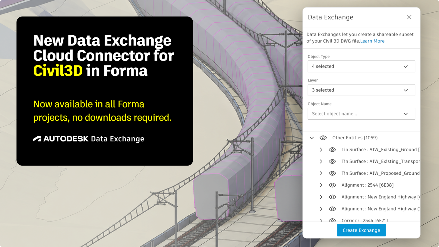
Back in May, we opened the Civil 3D Data Exchange connector to public beta, giving infrastructure teams a direct path from Civil 3D into Forma, Revit, and the broader Autodesk Data Exchange ecosystem. Today, we're excited to announce that the Civil 3D Cloud Connector is now Generally Available.
Over the beta period, hundreds of AEC and infrastructure teams used the connector to move corridor, pipe network, and surface data out of siloed DWG files and into cross-discipline workflows, without needing a Civil 3D license or desktop install to do it. GA means this is no longer an early-access preview. It's a supported, production-ready part of your Data Exchange Ecosystem.
Check out this video to see how the connector works!
What Carried Over From Beta
-
Geolocation-aware exchanges. Civil 3D and Revit models align on real-world coordinates, so infrastructure and building teams stay in the same spatial context without manual georeferencing. Check out our details of how to align the Civil 3D Exchange in Revit for Geolocated project Here.
-
Custom property export via Property Sets. Civil-specific metadata travels with your geometry, not just the shapes.
-
Automatic corridor solid export. Corridor solids generate as part of the exchange, removing a manual export step that used to sit between civil design and downstream consumption.
-
Broad object coverage. Corridors, pipe networks, surfaces, alignments, and profiles are all supported out of the box.
What's New for GA
Beta feedback pointed to five specific gaps between that we addressed with this release:
-
Solid properties support. Solid geometry now carries its full property set through the exchange.
-
Layer filtering fixed. Filtering by layer no longer drops child geometry. What you filter is what you get, with no silent data loss.
-
Geolocation distortion fix. A geometry distortion issue affecting geolocated exchanges has been resolved, so georeferenced Civil 3D models now hold their true shape in Revit and Forma, not just their true position.
-
Simplified property viewing. Properties now surface directly when you click an object in ACC, replacing the earlier flow that left users unsure where to find object data.
-
Layer color support. Exchanged geometry now inherits color directly from its Civil 3D layer color, so visual context carries over.
-
Bridge and bridge parts support. Bridge objects and their individual bridge parts are now supported, expanding on public beta scope. Once loaded into Revit, bridge parts can be selected individually, with their properties loaded and viewed separately, giving teams finer-grained control and visibility over bridge data in Data Exchange workflows.
-
Selectable corridor solids in Revit. Corridor solids now come into Revit as individually selectable corridor elements instead of a single combined entity. This resolves a major beta limitation raised by customers who needed to isolate corridor subassemblies, inspect their properties, and work with more granular civil data directly in downstream Revit workflows.
A Live Reference Underlay for Construction Drawings in Revit
Architectural and building teams often need to see exactly where site utilities and infrastructure sit relative to their building design, without becoming civil engineers themselves. Historically, that meant exporting CAD files out of Civil 3D and importing them into Revit as a reference, then maintaining a live CAD link so the reference stayed current as the civil design changed. That export and import cycle, and the overhead of keeping those links alive.
With the Civil 3D Cloud Connector, teams can bring Civil 3D data straight into Revit as a Data Exchange underlay instead. Corridors, pipe networks, bridges, and other site infrastructure show up in their exact geolocated positions directly inside the Revit architectural project, as a live reference tied to the exchange rather than a static, manually maintained CAD import. Architects and structural teams get accurate context for construction and design drawings without ever leaving Revit or touching a CAD export.
Check out the detailed process for linking Civil3D Data in Revit from our Public Beta Preview, similar process can be replicated to load Civil3D Data in other Application through Data Exchange connectors.
Property-Set-Driven 4D Insights With Power BI and Forma
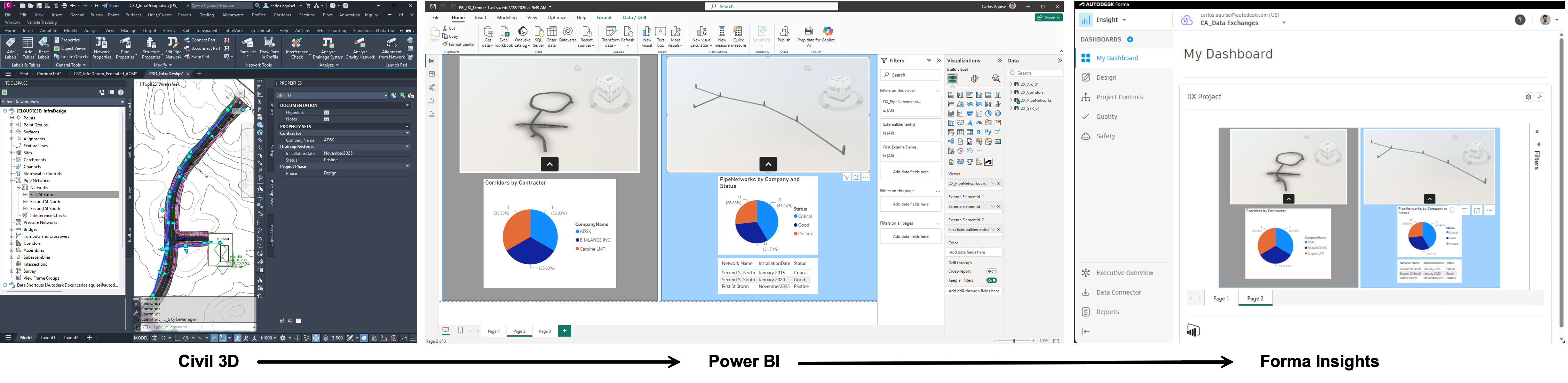
One of the workflows unlocked by the connector goes beyond geometry exchange entirely. Civil 3D Cloud Connector can be used to drive 4D construction sequencing, controlled by property sets defined directly in Civil 3D.
Here's how it works:
-
Tag objects in Civil 3D. Civil 3D objects carry user-defined Property Sets describing construction schedule, sequence, or milestone data.
-
Exchange the data. Those property sets travel through Data Exchange along with the geometry.
-
Build a Power BI visual. The exchanged data feeds a custom Power BI visual, using the property sets as filters to slice the model by schedule, sequence, or milestone.
-
Push to Power BI online. The dashboard is published so it can be surfaced elsewhere.
-
Surface it in Forma Insights. A card is created in Forma Insights by copying in the exchange URL, putting the live dashboard directly alongside the model.
The result is a dashboard that lets project teams filter and visualize construction progress by the exact schedule and milestone data they already track in Civil 3D, without leaving the tools they use for insight and reporting. This is one example of what becomes possible once civil data flows freely between Civil 3D, Power BI, and Forma. There's plenty of room for teams to build their own variations.
Why This Matters for Infrastructure Teams
Civil and structural or building workflows have historically lived in separate tools with separate coordinate systems and separate file formats. Data Exchange closes that gap without asking civil teams to change how they work in Civil 3D, or asking Revit and Forma teams to open a DWG. That's the same interoperability thesis driving Data Exchange across every connector.
Get Started
The Civil 3D Cloud Connector is available now in your Data Exchange-enabled ACC projects. Head to our help documentation to get started, or check out the geolocated Civil 3D to Revit workflow in action.
As always, we want your feedback. Reach out via DX Forum to tell us on what's next on your infrastructure interoperability wishlist.